



Select NOAA-NWS Forecast Office Text Products
(Product availability varies with seasons, forecast office, and weather.)
Hazardous Weather Outlook for Green Bay, WI
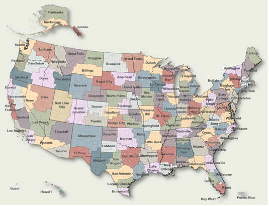
To Select Another NWS Office Click on Map or Choose from List
|
| Select Forecast Office: | Select Product: |
574 FLUS43 KGRB 110416 HWOGRB Hazardous Weather Outlook National Weather Service Green Bay WI 1116 PM CDT Sat Oct 10 2026 WIZ005-010>013-018>022-030-031-035>040-045-048>050-073-074-120430- Vilas-Oneida-Forest-Florence-Northern Marinette County-Lincoln- Langlade-Menominee-Northern Oconto County-Door-Marathon-Shawano- Wood-Portage-Waupaca-Outagamie-Brown-Kewaunee-Waushara-Winnebago- Calumet-Manitowoc-Southern Marinette County- Southern Oconto County- 1116 PM CDT Sat Oct 10 2026 This Hazardous Weather Outlook is for north-central and northeast Wisconsin. .DAY ONE...Tonight The probability for widespread hazardous weather is low. .DAYS TWO THROUGH SEVEN...Sunday through Saturday There is a slight chance for thunder Monday evening, though severe weather is not expected. .SPOTTER INFORMATION STATEMENT... Spotter activation will not be needed tonight or Sunday. $$ LMZ521-522-541>543-120430- The Bay of Green Bay south of a line from Cedar River MI to Rock Island Passage-Lake Michigan from Washington Island to Sheboygan- 1116 PM CDT Sat Oct 10 2026 This Hazardous Weather Outlook is for portions of northwest Lake Michigan and the waters of Green Bay. .DAY ONE...Tonight Conditions hazardous to small craft are expected due to gusty southerly winds and high waves. Small Craft Advisories remain in effect. .DAYS TWO THROUGH SEVEN...Sunday through Saturday Conditions hazardous to small craft will continue through midday Sunday for the Lake Michigan nearshore waters. Conditions hazardous to small craft may briefly return on Tuesday, then again late next week. $$ Kurimski |
Previous Hazardous Weather Outlooks may be found at
NWS Green Bay, WI (GRB) Office Hazardous Weather Outlooks.
(Click 'Previous Version' there to view past versions successively.
Some may differ only in time posted.)
Products Courtesy of NOAA-NWS
NWS Information Parsing Script by Ken True at Saratoga Weather - WFO and Products Scripts by SE Lincoln Weather.
Mapping by Curly at Michiana Weather and by Tom at My Mishawaka Weather.
